New Forest
Ashley walk
01.
Overview
[The walking suggestions in this web site are merely to show you some nice, fairly short walks within the New Forest National Park, so you can enjoy the Forest at its best. The walks have been completed by me, and follow used walking tracks.
Disclaimer: I cannot and do not take responsibility for you getting lost, bogged down, chased by a pony or suffering any other unfortunate incident or accident while using material from my website!]
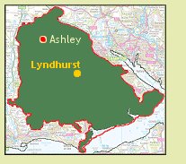
Ashley Walk is a popular, medium length walk starting and ending near the rural village of Godshill, in the north of the New Forest. The walk takes in a good mixture of open heathland, forested inclosure and Ancient and Ornamental Woodland.
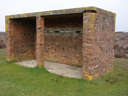
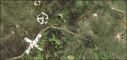
More importantly, Ashley Walk takes you round the perimeter of what was a major Second World War site, Ashley Bombing Range. Still clearly visible are the chalk target markings, numerous bomb and mortar craters and an observation shelter, along with many other tell-tale signs of wartime bomb-testing activities.
Table of Contents
Toggle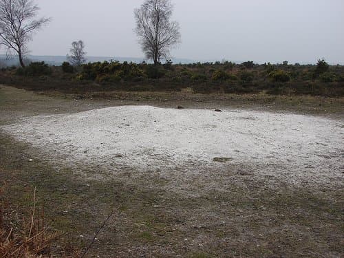
Location Information
- Car park location:
OS ref: SU187157 – GPS lat/long: 50.939,-1.737 - Approximate distance of Ashley walk:
Six miles - Allow (time):
Three hours - Nearest pub/s:
The Fighting Cocks at Godshill, a few hundred metres from Ashley Walk car park.
Target markings and craters on Ashley Heath, very visible in this modern day aerial shot. Explore present day Ashley Walk in detail.
Important update: Regrettably the OS map excerpt previously shown for this walk can no longer be used on this website. The walk is doable without it, by following the directions and photos outlined below, but please take extra care. If you don’t feel confident about trying the walk without the map excerpt, please don’t!
You can buy our offline map by clicking here or the Pocket Guide Image.
I put together a handy downloadable pocket guide ebook containing all of the walks from this website plus many pages of fascinating facts, essential local tips and useful information regarding the New Forest. All of which is available for download in a completely ad free, mobile friendly format. Suitable for use in all smartphones, tablets and kindles etc. Save some ink and the hassle of printing by downloading the New Forest National Park Pocket Guide right here, the only one of it’s kind and found no where else!
The Walk..
- Car park location:
OS ref: SU187157 – GPS lat/long: 50.939,-1.737 - Approximate distance of Ashley walk:
Six miles - Allow (time):
Three hours - Nearest pub/s:
The Fighting Cocks at Godshill, a few hundred metres from Ashley Walk car park.

Target markings and craters on Ashley Heath, are very visible in this modern-day aerial shot. Explore present-day Ashley Walk in detail.

Ashley Walk car park is situated right next to the Brook-Fordingbridge road, just before entering Godshill. Start the walk by following the main gravel track from near the car park entrance, walking away from the road.
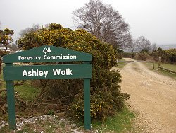
The start of Ashley Walk gives a good view across Black Gutter Bottom, a very typical New Forest panoramic scene! Follow the track across the valley.
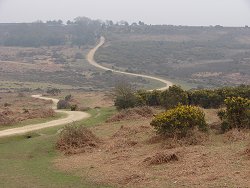
Continue to follow the main track, after nearly a mile you’ll pass a pile of chalk on the right hand side, opposite a track coming in from the left. This chalk was used to make the target markings on the bombing range.

A short distance past the chalk, the track goes downhill and into woodland with grassy areas. Stay on this track and cross Ashley Bottom, then up the other side through the pine trees (Pitts Wood Inclosure). Look for the cast iron inclosure plaque as you exit the trees.
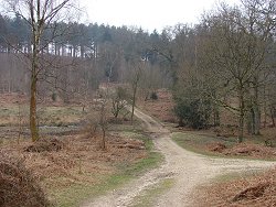
Immediately after exiting Pitts Wood Inclosure, you’ll come to a crossroads – take the left turn and just keep following this track.
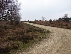
Shortly after turning left, look over your right shoulder to view the large mound behind you. This covers a replica German submarine bunker, constructed to test bombing effects on the seemingly indestructible German sub bunkers during the war.
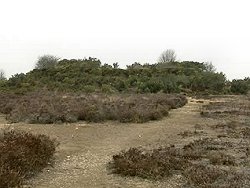
Continue along this track (easterly heading) and after about half a mile you’ll reach the north-western side of Amberwood Inclosure, on the right of the track. Just as the track starts to go downhill into the trees, (with an inclosure gate on the right), turn sharp left at the cycle-route marker, opposite the gate.
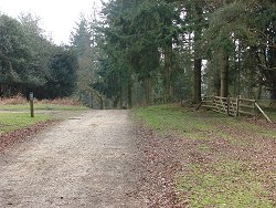
About 150 metres after turning left, there is a small brick building across to the left of the track. This is the last remaining bombing observation shelter of Ashley Range – walk through the heather and step inside the shelter, stepping back in history in the process!

From the shelter, return to the main track and follow it on its northerly direction. You’ll have the open heath of Ashley Range on your left, and Islands Thorns Inclosure on the right.
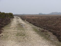
After about one and a half miles from leaving the shelter, there is a small track going off to the left. It isn’t always obvious, but if you’re in the right place then you’ll look down this track and see a small group of trees in the distance, on roughly the same line as the track. Take this turn and follow the track through the heather.
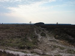
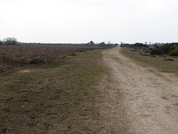
After a couple of hundred metres the track turns sharply left, then after 3/4 of a mile or so reaches a large open circular grassy area. Head across this diagonally to the right, then pick up the path from the northerly end of the circle. This path takes you back to the chalk pile you passed earlier. Turn right here and follow the track back to the car park.

Charity Events to Take Part in
Charity Events to Take Part in Around the New Forest If you are ready to do something good and make a difference in the world, you will be pleased to hear that there are

Spring Camping Trip with Mum
5 Must-Have Essentials for a Spring Camping Trip with Mum in the New Forest Planning a spring camping trip with your mother can transform a typical Mother’s Day into an enduring tale. New Forest, with

World Clean Up Day
World Clean Up Day: Bringing the country together to conserve our environment National and World Cleanup Day takes place on the third Saturday of September. World Clean Up Day is a beloved event that mobilizes

Best Cycling Trails in New Forest
Best Cycling Trails in New Forest: Discover Scenic Routes for All Skill Levels Indeed, the New Forest bristles with some of the most exceptional cycling trails suitable for all skill levels. Keen cyclists and novices

Brockenhurst New Forest Hotels
Brockenhurst New Forest Hotels & Accommodation Brockenhurst is a charming village located in the heart of the New Forest National Park in Hampshire, England. Known for its picturesque natural scenery, quaint villages, free-roaming ponies, and
Best Camping Fridges UK
Best Camping Fridges UK – Reviewed for 2023 If you’re looking to enjoy your time away from the civilization, planning an outdoor camping trip requires thoughtful preparation. Nothing is more crucial than the right equipment. Portable fridges
