How Satellite Imagery is Transforming Wildlife Conservation
How Satellite Imagery is Transforming Wildlife Conservation Across the Globe
Today, a myriad of species and their habitats are struggling to survive and are on the verge of extinction due to permanent pressure on deforestation, climate change, and unlawful activities like illegal mining and logging. These critical challenges require up-to-date and technological solutions.

Satellite imagery is a perfect example of how issues on the ground can be solved in space. Detailed near-real time satellite maps received from Landsat or Sentinel satellites can be analyzed by advanced platforms and algorithms, offering a set of solutions with modern tools. With these results, conservationists can precisely track habitat destruction, animal migration, and changes in ecosystems. As a result, satellite imagery allows to stop threats before they escalate into irreversible damage.
A Bird’s-Eye View of Ecosystems
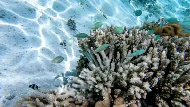
On-the-ground solutions, such as scouting, rangers, cameras, and site surveys, continue to be a valuable tool for maintaining conservation efforts. However, the scale and speed of advanced satellite tools can’t be matched on Earth. Thanks to satellite data, scientists can now take a wide-angle look at entire ecosystems, whether it’s dense rainforests or fragile coral reefs. With the help of advanced sensors and analytical tools, they can spot changes as they happen, without needing to send teams into the field. It’s not only faster, but also far more cost-effective than organizing full-scale expeditions on the ground. In general, the advantages of using satellite imagery for conservation fall into a few key areas:
- Standardized time-series data: Satellites collect data under consistent conditions regularly. It is ideal for tracking trends like vegetation loss, water levels, and land degradation. For example, AI-supported satellite systems can now identify plastic dumps as small as 5 meters by 5 meters.
- Speed and scale: One satellite sweep can cover thousands of square kilometers. A recent study revealed that Earth lost over 4,000 square kilometers of tidal wetlands in just two decades, based on data exclusively obtained from Landsat data provided by the U.S. Geological Survey.
- Access to the inaccessible: In Antarctica, satellites revealed a hidden colony of 1.5 million Adélie penguins, undetected by humans for centuries. This discovery not only expanded scientists’ understanding of the species’ range but also highlighted previously unknown habitats that may need protection.
- Accurate counts and snapshots: Large-scale imagery minimizes errors caused by duplicate counts or animal movement during manual surveys. As a result, population estimates become more reliable, allowing conservationists to prioritize their efforts for species recovery with greater precision.
- Non-invasive approach: No ground presence means no disruption to fragile species or habitats. This is especially important for breeding animals or endangered species that are highly sensitive to human disturbance, ensuring data can be gathered without affecting natural behaviors.
Detecting Habitat Loss and Deforestation
Habitat loss is one of the biggest threats to wildlife worldwide, pushing countless species closer to extinction. With space-based tools like Sentinel-2 and Landsat, conservationists now detect these changes by analyzing reflectance patterns in current satellite image datasets. These satellites capture multi-spectral imagery data in visible and infrared bands, allowing researchers to distinguish between healthy vegetation, bare soil, water, and man-made features. By comparing new images with archived historical records, scientists can automatically flag forest loss, changes in vegetation density, and signs of land conversion like roads or agriculture.
For example, if a pixel that previously reflected strong near-infrared signals from dense forest suddenly shows increased red-band reflectance (typical of bare ground), algorithms can mark that as potential deforestation. Systems like Brazil’s DETER (Real-Time Deforestation Detection System) use such changes to trigger alerts, helping enforcement teams investigate illegal logging or land clearing, often within days.
In coastal Ecuador, where nearly 98% of native rainforest has disappeared, Sentinel-2 data helps conservationists map what little remains. At the 650-hectare Jama-Coaque Ecological Reserve, these tools are essential for designing forest corridors and monitoring regrowth. Every updated satellite image reveals not only what has been lost, but what can still be restored.
Tracking Migration and Species Movement
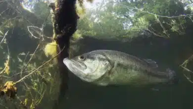
Wildlife doesn’t recognize political borders, and neither does satellite technology. From whales crossing oceans to elephants traversing savannas, species are constantly on the move. By combining GPS tracking collars with live Earth satellite view data, scientists can now visualize migration corridors, detect threats, and safeguard vital stopover sites with far greater accuracy than ever before.
In protected areas across Africa, high-resolution imagery combined with field data is helping locate endangered animals in remote or dangerous regions. For example, current satellite images, analyzed with AI tools, guide rangers to likely animal locations. This creates real-time “heat maps” of species activity, allowing conservationists to plan activities even across large, fragmented reserves.
Sometimes, live satellite images help to detect cases of illegal activities. According to the CCF Annual Review, in South Africa’s Madikwe Game Reserve, with the help of satellite imagery, conservationists revealed two rhino carcasses near an unauthorized track, allowing investigators to estimate the time of death, trace poacher access routes, and coordinate a targeted law enforcement response.

Responding to Climate-Driven Disasters
Unfortunately, climate-related disasters become more common nowadays, threatening already vulnerable wildlife. Satellites provides scientists with environmental indicators that allow to analyze vegetation stress, land degradation, moisture levels. They are pretty critical to predict wildfires, droughts, and floods before they happen.
For example, NASA’s MODIS and ESA’s Sentinel-3 satellites measure thermal anomalies and vegetation indices to detect fire risks across landscapes, such as Australia’s bushland or California’s forests. In Africa’s Sahel region, satellite-derived drought forecasts have helped conservationists and governments plan emergency water delivery for elephants and antelope herds. With the timely alarms from space, animals can be relocated, food and water supplies can be secured. After a disaster strikes, conservationists can develop recovery plans based on data, rather than guesswork.
Looking Ahead
Artificial intelligence and live satellite views are changing the way we protect wildlife. Today, smart algorithms can process huge amounts of satellite data to spot early signs of habitat loss, poaching, or shifts in animal behavior, often before anyone on the ground would notice. That means conservation teams can act faster and focus their efforts where they’re needed most.
These tools don’t just react to problems, they help predict them, picking up patterns that humans might miss and giving us the chance to prevent damage before it happens. As satellite tech keeps improving, so does our ability to track endangered species and fragile ecosystems almost in real time. Whether it’s tracing migration paths or uncovering illegal land clearing, satellites are becoming essential to modern conservation.
______________
Author :
Kateryna Sergieieva has a Ph.D. in information technologies and 15 years of experience in remote sensing. She is a scientist responsible for developing technologies for satellite monitoring and surface feature change detection. Kateryna is an author of over 60 scientific publications.