
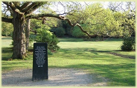
The Rufus Stone is accessible from the north and the south, with the latter being the easiest and quickest way.You need to be on the eastbound carriageway of the
A31, the turning down to Rufus Stone is on the left, approximately halfway between the Stoney Cross and Cadnam exits.
Coming from the north, take the small road that rises uphill directly opposite the Bell Inn at Brook. After about a mile, the Stone is immediately after the Sir Walter Tyrrell pub, on the right.
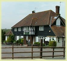
A third option is to reach the stone (and pub!) by foot or on bike, coming down through Longbeech campsite on Stoney Cross. This is a very pleasant stroll but parts can get boggy after heavy rain, and there’s a stream to negotiate at the bottom!
GPS / SatNav information:
Lat/long: 50.911,-1.617. OS grid ref: SU270125

Why Egypt Changes You
The Kind of Journey You Don’t Expect Most trips start the same way. You plan, you pack, you imagine what it’s going to feel like when you finally get there. Maybe you’re chasing good weather,
Keep New Forest Water Clean
The New Forest National Park is home to some of the UK’s most valuable freshwater habitats, from rare headwater streams to seasonal ponds that appear and disappear with the rainfall. Despite its protected status, these
Understanding Firearm Policies
Yes, a person can legally carry a firearm in national parks, but the rule is narrower than it sounds. Firearm policies in and around national parks start with a 2010 change in federal law. That

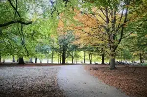
A Guide to Trails and Park Terrain
There is a specific smell that hits you the moment you step out of the car in the New Forest. It is a mix of damp oak leaves, ancient soil, and honestly, a little bit

New Forest Activities for Single-Parent Families
The New Forest offers a wealth of year-round experiences perfect for single-parent families looking to create lasting memories. From spring woodland walks surrounded by bluebells to summer picnics by gentle streams, the national park provides
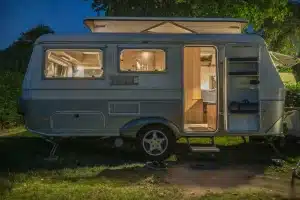
Practical Equipment for Life on the Road
More people choose mobile living every year, from weekend caravanners to full-time digital nomads. Homes on wheels promise freedom, changing scenery, and a lifestyle that breaks away from traditional routines. That lifestyle only feels comfortable