Slufters Inclosure Walk
New Forest
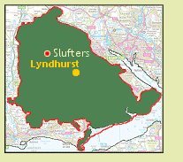
Slufters Inclosure walk
[The walking suggestions in this web site are merely to show you some nice, fairly short walks within the New Forest National Park, so you can enjoy the Forest at its best. The walks have been completed by me, and follow used walking tracks.
Disclaimer: I cannot and do not take responsibility for you getting lost, bogged down, chased by a pony or suffering any other unfortunate incident or accident while using material from my website!]
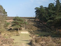
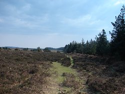
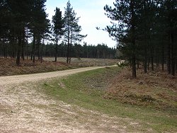
Slufters Inclosure walk is a nice, short walk that gives you great views of open heathland and forested inclosures managed by the Forestry Commission. It can get very boggy in places outside of the inclosure, so be warned! There’s almost always a way round though.
On entering the inclosure, look out for deer hiding in the trees or grazing on the grassy rides. Slufters rarely get busy, and New Forest wildlife can often be seen on this walk.
NB: due to seemingly endless FC work within Slufters, the photos here might not be an accurate representation of the current state of the walk!
Slufters Inclosure walk
Important update: Regrettably the OS map excerpt previously shown for this walk can no longer be used on this website. The walk is doable without it, by following the directions and photos outlined below, but please take extra care. If you don’t feel confident about trying the walk without the map excerpt, please don’t!
You can buy our offline map by clicking here or the Pocket Guide Image.
I put together a handy downloadable pocket guide ebook containing all of the walks from this website plus many pages of fascinating facts, essential local tips, and useful information regarding the New Forest. All of which is available for download in a completely ad-free, mobile-friendly format. Suitable for use in all smartphones, tablets kindles etc. Save some ink and the hassle of printing by downloading the New Forest National Park Pocket Guide right here, the only one of its kind and found nowhere else!
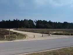
Direct vehicle access to the car park has been blocked off, so park at the track entrance but don’t block the gate! Better parking is of course available at nearby Cadmans Pond or Ocknell, both a few hundred metres to the north-east of Slufters (back towards Stoney Cross airfield).
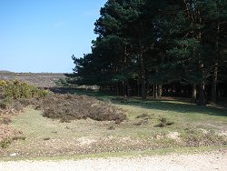
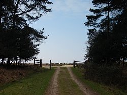
Walk down the car park entrance track from the road. Standing in the car park, face east (left) – the main gate into Slufters Inclosure will be on your right. Begin your walk down the grassy slope through the pine trees. The heather expanse of Ocknell Plain is on your left.
Cross over the small Forest stream at the bottom of the dip (bridged with a gravel path) and walk up the other side, sticking to the narrow gravel/sand pony tracks. Warning – can be boggy here!
On reaching the top of the hill, turn right and follow the line of the inclosure fence. You’re now up on Ocknell Plain, and there are several narrow pony tracks to walk on. Keep the inclosure on your right. If using a compass, you’ll be walking a southerly heading.
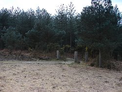
After about 1/3 mile, there is a set of old gate posts into the inclosure. Don’t go through here, unless you can’t wait to get to the pub, but keep walking straight on, still with the inclosure on your right. Keep walking for about the same distance again (1/3 mile approx.) and you’ll soon be in view of the busy A31 road, directly ahead of you.
You’ll encounter some boggy areas along the way, but soon you’ll come to another similar set of gate posts into the inclosure, on the right. Go through these and walk down the short slope (gravel track) to the crossroads at the bottom.
The main Forestry Commission track runs left-right, and you need to go to the right. If using a compass, you’ll be walking a northerly heading.
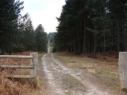
Just keep on this main track and it will take you back to the car park, from inside the inclosure. There are a few crossroads on the way, but you keep walking on the gravel track. You’ll see some New Forest Ancient & Ornamental Woodland on your right, containing mostly oak trees, the rest of the inclosure is forested with pine.
Explore Milkham walk from above, using satellite imagery; get to know the area before you try the walk!
Related Pages:

A Guide to Trails and Park Terrain
There is a specific smell that hits you the moment you step out of the car in the New Forest. It is a mix of damp oak leaves, ancient soil, and honestly, a little bit

New Forest Activities for Single-Parent Families
The New Forest offers a wealth of year-round experiences perfect for single-parent families looking to create lasting memories. From spring woodland walks surrounded by bluebells to summer picnics by gentle streams, the national park provides

Practical Equipment for Life on the Road
More people choose mobile living every year, from weekend caravanners to full-time digital nomads. Homes on wheels promise freedom, changing scenery, and a lifestyle that breaks away from traditional routines. That lifestyle only feels comfortable
How to Enjoy the New Forest’s Nature and Wildlife Without Breaking the Bank
The New Forest is one of the UK’s most cherished landscapes, a place where ancient woodlands, open heathlands, free-roaming ponies, and peaceful villages come together to create an unforgettable outdoor escape. And while many people

Why Time in Nature Complements Daily Astrological Guidance
Many of us start the morning with a quick look at our horoscope. A few lines can help name our mood, highlight a tension, or point out an opening in the day. What often gets
UK’s best natural spots
Wilderness escapes are not for everyone, that’s for sure. Some people simply prefer holidays where they can lounge all day and take it easy instead of being active, going hiking, swimming, or cycling. But there

